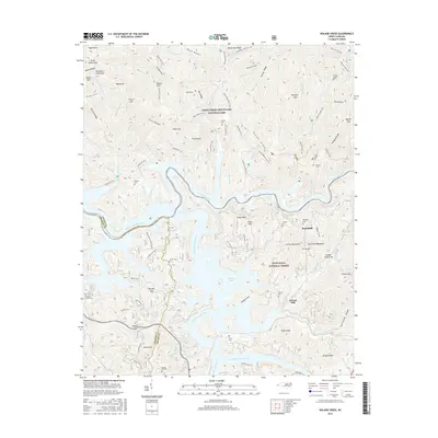
2016 Map of Noland Creek
USGS Topo · Published 2016About this map
Fontana Lake dominates the central landscape of this Swain County survey, where the waters of the Little Tennessee River and the Tuckasegee River converge. The topography is defined by the high ridges of the Great Smoky Mountains National Park to the north and the Nantahala National Forest to the south. Numerous small family and community burial grounds, including the Roundhill Cem and Woody Cem, are scattered across the terrain, offering significant primary data for genealogical research in this part of North Carolina. The map illustrates a remote mountain economy transitioned into a protected wilderness, yet it still preserves the locations of local landmarks like Carson Mill and the Co Line Plantation. Extensive trail networks, such as the Lakeshore Trail and Noland Creek Trail, trace the historic routes through the valleys of Noland Creek and Bear Creek.
Find a feature on this map
110 named features on this map. Tap any name to fly to it.
Don’t see what you’re looking for? This feature index may not catch every label — zoom into the map to look around manually.
Map Details
Editions of this 2016 Noland Creek Map
This is the sole edition of this map. No revisions or reprints were ever made.
Other maps of this area

1886 · Knoxville
USGS Topo · 1:125,000

1891 · Cowee
USGS Topo · 1:125,000

1892 · Knoxville
USGS Topo · 1:125,000

1893 · Mt Guyot
USGS Topo · 1:125,000

1894 · Knoxville
USGS Topo · 1:125,000

1895 · Knoxville
USGS Topo · 1:125,000

1897 · Cowee
USGS Topo · 1:125,000

1901 · Knoxville
USGS Topo · 1:125,000

1907 · Cowee
USGS Topo · 1:125,000

1912 · Mt Guyot
USGS Topo · 1:125,000