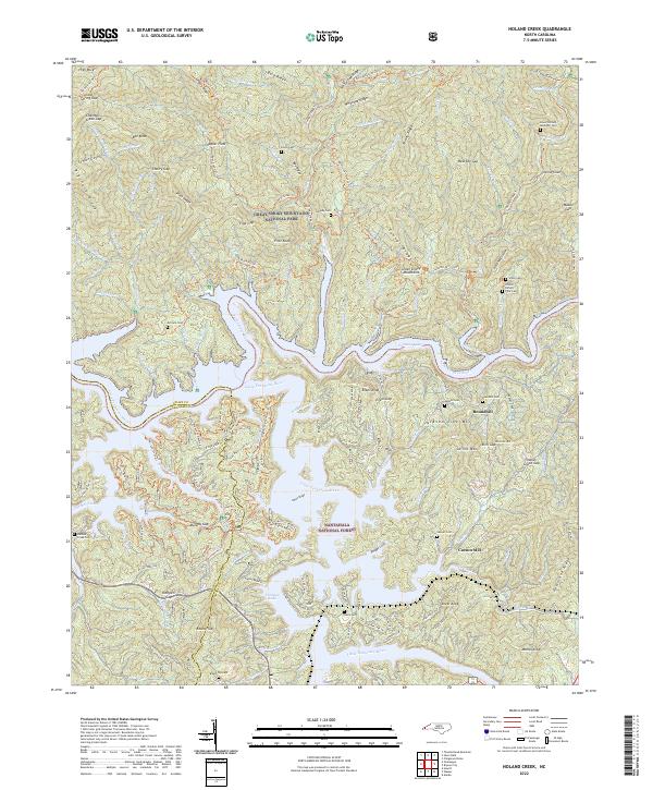
2022 Map of Noland Creek
USGS Topo · Published 2022About this map
Great Smoky Mountains National Park and Nantahala National Forest meet along the dramatic shoreline of Fontana Lake in this contemporary topographic survey. The landscape is defined by the convergence of the Tuckasegee River and the Little Tennessee River, creating a complex network of inlets and coves including Phipps Cove and Fowler Cove. High elevations are marked by prominent peaks such as Pilot Knob and Evans Knob, while the intricate topography is traversed by numerous established paths like the Lakeshore Trl and the Tsali Left Loop Trl.
Find a feature on this map
118 named features on this map. Tap any name to fly to it.
Don’t see what you’re looking for? This feature index may not catch every label — zoom into the map to look around manually.
Map Details
Editions of this 2022 Noland Creek Map
This is the sole edition of this map. No revisions or reprints were ever made.
Other maps of this area

1886 · Knoxville
USGS Topo · 1:125,000

1891 · Cowee
USGS Topo · 1:125,000

1892 · Knoxville
USGS Topo · 1:125,000

1893 · Mt Guyot
USGS Topo · 1:125,000

1894 · Knoxville
USGS Topo · 1:125,000

1895 · Knoxville
USGS Topo · 1:125,000

1897 · Cowee
USGS Topo · 1:125,000

1901 · Knoxville
USGS Topo · 1:125,000

1907 · Cowee
USGS Topo · 1:125,000

1912 · Mt Guyot
USGS Topo · 1:125,000