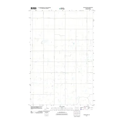
2011 Map of Noonan SW
USGS Topo · Published 2011About this map
The high plains of Divide County, North Dakota, are defined here by the rigid geometry of the Public Land Survey System, which has etched a precise grid of gravel and dirt roads across the landscape. The infrastructure is centered around cardinal thoroughfares like 117th Ave NW and 100th St NW, facilitating transport through this agricultural region. This 2011 survey reveals a terrain pockmarked with hundreds of small prairie potholes and seasonal wetlands, illustrating the glacial legacy of the Missouri Coteau. These water bodies dot the sections between 113th Ave NW and 118th Ave NW, creating a mosaic of land and water that dictates the placement of farmsteads and field boundaries. The sparse settlement pattern, with only occasional structures noted along routes like 99th St NW and 95th St NW, reflects the expansive scale of modern prairie farming in the early 21st century.
Find a feature on this map
12 named features on this map. Tap any name to fly to it.
Don’t see what you’re looking for? This feature index may not catch every label — zoom into the map to look around manually.
Map Details
Editions of this 2011 Noonan SW Map
This is the sole edition of this map. No revisions or reprints were ever made.
Other maps of this area

1947 · Noonan
USGS Topo · 1:24,000

1948 · Alamo N.E.
USGS Topo · 1:24,000

1948 · Crosby
USGS Topo · 1:24,000

1948 · Crosby SE
USGS Topo · 1:24,000

1949 · Paulson
USGS Topo · 1:24,000

1949 · Noonan SW
USGS Topo · 1:24,000

1949 · Noonan SE
USGS Topo · 1:24,000

1949 · Noonan
USGS Topo · 1:24,000

1950 · Crosby
USGS Topo · 1:62,500

1950 · Noonan
USGS Topo · 1:62,500