
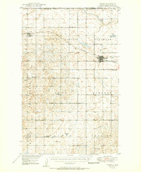
1950 Map of Crosby
USGS Topo · Published 1950About this map
The Canada United States border and the Montana state line define the northwestern corner of this North Dakota landscape, where agricultural townships like Blooming Prairie and Hawkeye meet the international boundary. The city of Crosby serves as a regional hub at the junction of the Great Northern and the Minneapolis Sault Ste Marie and St Paul railroads. This era of prairie settlement is marked by a dense network of country schools, including Lexington Sch and Roseville Sch, alongside community centers such as Bethlehem Ch and the Crosby Country Club. Farther west, the town of Ambrose sits near the Ambrose Cem, while the rugged terrain of Twin Butte contrasts with the cultivated fields along Crosby Creek. The map documents a time when small rural school districts and local town halls remained the primary social infrastructure for Divide County.
Find a feature on this map
37 named features on this map. Tap any name to fly to it.
Don’t see what you’re looking for? This feature index may not catch every label — zoom into the map to look around manually.
Map Details
Editions of this 1950 Crosby Map
2 editions found
Other maps of this area

1948 · Smoky Butte
USGS Topo · 1:24,000

1948 · Alamo N.E.
USGS Topo · 1:24,000

1948 · Crosby SW
USGS Topo · 1:24,000

1948 · Ambrose
USGS Topo · 1:24,000

1948 · Bright Water Lake
USGS Topo · 1:24,000

1948 · Crosby
USGS Topo · 1:24,000

1948 · Crosby SE
USGS Topo · 1:24,000

1949 · Paulson
USGS Topo · 1:24,000

1949 · Noonan SW
USGS Topo · 1:24,000

1950 · Noonan
USGS Topo · 1:62,500