
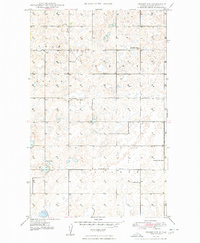
1948 Map of Crosby SW
USGS Topo · Published 1948About this map
Twin Butte and the surrounding townships of Troy, Burg, and Plumer define this corner of Divide County in the late 1940s. The landscape is characterized by a dense network of prairie potholes and small depressions, with agricultural life centered around several country schoolhouses and churches. Local civic life is anchored at the Town Hall, while education is distributed across rural nodes like Lexington Sch and Roseville Sch. The presence of both Whiteaker No 4 Sch and Whiteaker No 1 Sch suggests a strictly organized system of school districts serving the scattered farmsteads. Religious centers such as Troy Ch and Bethlehem Ch provide further evidence of the established social fabric in this remote northern plains environment prior to mid-century rural consolidation.
Find a feature on this map
11 named features on this map. Tap any name to fly to it.
Don’t see what you’re looking for? This feature index may not catch every label — zoom into the map to look around manually.
Map Details
Editions of this 1948 Crosby SW Map
2 editions found
Other maps of this area

1948 · Smoky Butte
USGS Topo · 1:24,000

1948 · Alamo N.E.
USGS Topo · 1:24,000

1948 · Ambrose
USGS Topo · 1:24,000

1948 · Bright Water Lake
USGS Topo · 1:24,000

1948 · Crosby
USGS Topo · 1:24,000

1948 · Crosby SE
USGS Topo · 1:24,000

1950 · Crosby
USGS Topo · 1:62,500

1953 · Williston
USGS Topo · 1:250,000

1957 · Williston
USGS Topo · 1:250,000
1983 · Colgan East
USGS Topo · 1:24,000