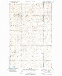
1948 Map of Crosby SW
USGS Topo · Published 1948About this map
The rolling plains of North Dakota in the years immediately following World War II reveal a rural landscape defined by township organization and small community centers. In this corner of Divide County, the transition between the townships of Troy, Burg, and Twin Butte is marked by a network of sectional roads and essential social anchors. Local life centered on the Town Hall and the small country churches of Troy Ch and Bethlehem Ch, which served the farming families of the high prairie.
Find a feature on this map
11 named features on this map. Tap any name to fly to it.
Don’t see what you’re looking for? This feature index may not catch every label — zoom into the map to look around manually.
Map Details
Editions of this 1948 Crosby SW Map
2 editions found
Other maps of this area

1948 · Smoky Butte
USGS Topo · 1:24,000

1948 · Alamo N.E.
USGS Topo · 1:24,000

1948 · Crosby SW
USGS Topo · 1:24,000

1948 · Ambrose
USGS Topo · 1:24,000

1948 · Bright Water Lake
USGS Topo · 1:24,000

1948 · Crosby
USGS Topo · 1:24,000

1948 · Crosby SE
USGS Topo · 1:24,000

1950 · Crosby
USGS Topo · 1:62,500

1953 · Williston
USGS Topo · 1:250,000

1957 · Williston
USGS Topo · 1:250,000