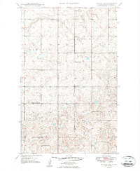
1949 Map of Noonan SW
USGS Topo · Published 1949About this map
The agricultural heart of Divide County is defined by a systematic grid of country schools and rural congregations in this late-1940s survey. The landscape is organized into civil townships including Blooming Valley, Hawkeye, Frazier, and Upland, each reflecting the homesteading legacy of the region. Local community life centered around places like Blooming Prairie Ch and Glenwood Ch, which provided essential social anchors for the surrounding farmsteads.
Find a feature on this map
11 named features on this map. Tap any name to fly to it.
Don’t see what you’re looking for? This feature index may not catch every label — zoom into the map to look around manually.
Map Details
Editions of this 1949 Noonan SW Map
2 editions found
Other maps of this area

1947 · Noonan
USGS Topo · 1:24,000

1948 · Alamo N.E.
USGS Topo · 1:24,000

1948 · Crosby
USGS Topo · 1:24,000

1948 · Crosby SE
USGS Topo · 1:24,000

1949 · Paulson
USGS Topo · 1:24,000

1949 · Noonan SW
USGS Topo · 1:24,000

1949 · Noonan SE
USGS Topo · 1:24,000

1949 · Noonan
USGS Topo · 1:24,000

1950 · Crosby
USGS Topo · 1:62,500

1950 · Noonan
USGS Topo · 1:62,500