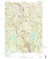
1956 Map of Norfolk
USGS Topo · Published 1976About this map
The Norfolk highlands and the surrounding Litchfield County landscape are documented here during the mid-1950s, with later updates showing water management developments. The map highlights a network of public lands including Haystack Mtn State Park and Dennis Hill State Park, alongside the expansive Algonquin State Forest to the east. These protected areas are interspersed with small agrarian and residential hubs like Grantville, South Norfolk, and North Goshen.
Find a feature on this map
68 named features on this map. Tap any name to fly to it.
Don’t see what you’re looking for? This feature index may not catch every label — zoom into the map to look around manually.
Map Details
Editions of this 1956 Norfolk Map
4 editions found
Other maps of this area

1885 · Sheffield
USGS Topo · 1:62,500

1888 · Sheffield
USGS Topo · 1:62,500

1888 · Sandisfield
USGS Topo · 1:62,500

1891 · Sheffield
USGS Topo · 1:62,500

1892 · Winsted
USGS Topo · 1:62,500

1892 · Cornwall
USGS Topo · 1:62,500

1893 · Sheffield
USGS Topo · 1:62,500

1893 · Cornwall
USGS Topo · 1:62,500

1893 · Sandisfield
USGS Topo · 1:62,500

1897 · Sandisfield
USGS Topo · 1:62,500