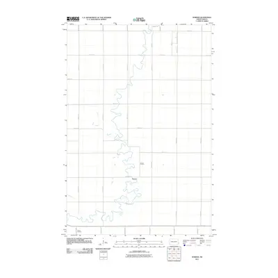
2011 Map of Norman
USGS Topo · Published 2011About this map
Norman serves as the focal point for this agrarian landscape in Cass County, where the winding course of the Sheyenne River dictates the local geography. This 2011 survey reveals a highly organized section line road network, including County Rd 17 S and County Rd 28, which facilitates movement through the vast open fields of the Red River Valley. The area maintains deep ties to its early settlers through preserved grounds like Norman Cemetery near the riverbank and Dokken Cemetery located further south. Residential pockets such as those along Sunset Dr and Robin Rd indicate modern residential expansion alongside traditional farming tracts. The map illustrates a transitional period where the original small settlement character remains visible even as infrastructure like County Rd 1 supports increased regional connectivity.
Find a feature on this map
26 named features on this map. Tap any name to fly to it.
Don’t see what you’re looking for? This feature index may not catch every label — zoom into the map to look around manually.
Map Details
Editions of this 2011 Norman Map
This is the sole edition of this map. No revisions or reprints were ever made.
Other maps of this area

1895 · Fargo
USGS Topo · 1:125,000

1895 · Casselton
USGS Topo · 1:125,000

1897 · Fargo
USGS Topo · 1:125,000

1897 · Casselton
USGS Topo · 1:125,000

1953 · Fargo
USGS Topo · 1:250,000

1956 · Fargo
USGS Topo · 1:250,000

1959 · Kindred
USGS Topo · 1:24,000

1959 · South West Fargo
USGS Topo · 1:24,000

1959 · Fargo South
USGS Topo · 1:24,000

1959 · Hickson
USGS Topo · 1:24,000