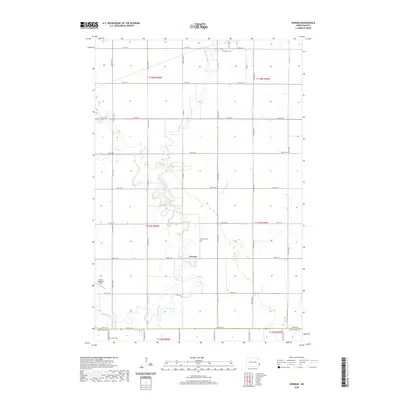
2020 Map of Norman
USGS Topo · Published 2020About this map
The Sheyenne River winds in tight, serpentine oxbows through the center of this landscape, defining the character of the Red River Valley borderlands. The settlement of Norman is positioned along these banks, serving as a focal point in a region primarily organized by the rigid grid of the Public Land Survey System. Genealogical interest is concentrated at several local burial sites, including Norman Cem near the river and Clemenson Cem to the north, as well as Perhus Cem located near the boundary between Cass Co and Richland Co. This 2020 map documents a late-modern era of the rural Midwest, where large-scale agriculture is punctuated by aviation landmarks like Robert Odegaard Field and an extensive network of township roads such as Co Rd 14 and 54th St SE.
Find a feature on this map
27 named features on this map. Tap any name to fly to it.
Don’t see what you’re looking for? This feature index may not catch every label — zoom into the map to look around manually.
Map Details
Editions of this 2020 Norman Map
This is the sole edition of this map. No revisions or reprints were ever made.
Other maps of this area

1895 · Fargo
USGS Topo · 1:125,000

1895 · Casselton
USGS Topo · 1:125,000

1897 · Fargo
USGS Topo · 1:125,000

1897 · Casselton
USGS Topo · 1:125,000

1953 · Fargo
USGS Topo · 1:250,000

1956 · Fargo
USGS Topo · 1:250,000

1959 · Kindred
USGS Topo · 1:24,000

1959 · South West Fargo
USGS Topo · 1:24,000

1959 · Fargo South
USGS Topo · 1:24,000

1959 · Hickson
USGS Topo · 1:24,000