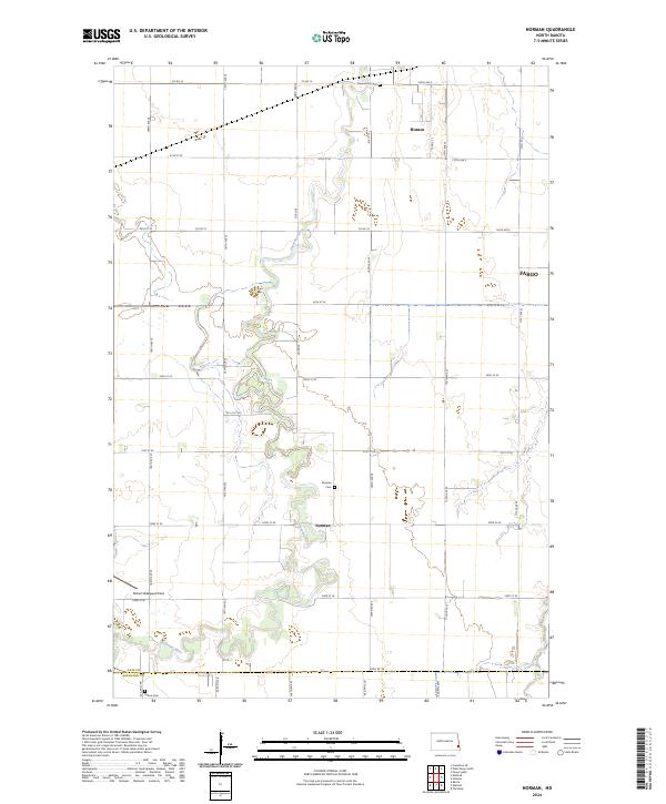
2024 Map of Norman
USGS Topo · Published 2024About this map
The Sheyenne River meanders in tight, complex loops across this section of the Red River Valley, defining the landscape south of Fargo. This modern survey reveals a largely agricultural plain structured by a rigid grid of section roads like Co Rd 16 and 52nd St SE, where small settlements and rural landmarks persist amidst the fields. The community of Norman and its namesake Norman Cem sit near the river's path, while the northern edge of the map captures the expansion of Horace. Cultural history is anchored by family and local sites, including Clemenson Cem to the north and Perhus Cem on the Richland County line. Aviation interest is represented by Robert Odegaard Field, a small landing strip located in the southwestern portion of the quadrangle.
Find a feature on this map
28 named features on this map. Tap any name to fly to it.
Don’t see what you’re looking for? This feature index may not catch every label — zoom into the map to look around manually.
Map Details
Editions of this 2024 Norman Map
This is the sole edition of this map. No revisions or reprints were ever made.
Other maps of this area

1895 · Fargo
USGS Topo · 1:125,000

1895 · Casselton
USGS Topo · 1:125,000

1897 · Fargo
USGS Topo · 1:125,000

1897 · Casselton
USGS Topo · 1:125,000

1953 · Fargo
USGS Topo · 1:250,000

1956 · Fargo
USGS Topo · 1:250,000

1959 · Kindred
USGS Topo · 1:24,000

1959 · South West Fargo
USGS Topo · 1:24,000

1959 · Fargo South
USGS Topo · 1:24,000

1959 · Hickson
USGS Topo · 1:24,000