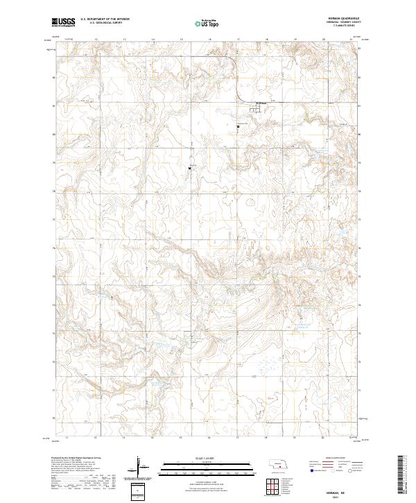
2021 Map of Norman
USGS Topo · Published 2021About this map
The settlement of Norman anchors this section of Kearney County, serving as a focal point for a landscape defined by organized agricultural plots and a network of named reservoirs. The terrain is structured by a rigid grid of rural roads, including K Rd and 40 Rd, which partition the territory into distinct sections. Water management is a critical feature of this Nebraska landscape, evidenced by the clustered placement of Reiss Reservoir Number 1 and Reiss Reservoir Number 2 alongside smaller impoundments like Petersen Reservoir and Christensen Reservoir. Local heritage is preserved at the Norman Cem and May Cem, which are positioned near the intermittent courses of Sand Cr and its southern branch. The map illustrates a contemporary view of the Great Plains' rural infrastructure, where the natural drainage of S Br Sand Cr meets the engineered utility of the mid-20th-century irrigation and water storage systems.
Find a feature on this map
30 named features on this map. Tap any name to fly to it.
Don’t see what you’re looking for? This feature index may not catch every label — zoom into the map to look around manually.
Map Details
Editions of this 2021 Norman Map
This is the sole edition of this map. No revisions or reprints were ever made.
Other maps of this area

1894 · Kenesaw
USGS Topo · 1:62,500

1894 · Minden
USGS Topo · 1:62,500

1896 · Wood River
USGS Topo · 1:125,000

1897 · Red Cloud
USGS Topo · 1:125,000

1955 · Grand Island
USGS Topo · 1:250,000

1957 · Grand Island
USGS Topo · 1:250,000

1958 · Grand Island
USGS Topo · 1:250,000

1969 · Upland
USGS Topo · 1:24,000

1969 · Upland SE
USGS Topo · 1:24,000
1969 · Holstein
USGS Topo · 1:24,000