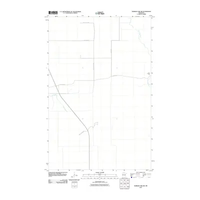
2010 Map of Norman Lake SW
USGS Topo · Published 2010About this map
Red Lake State Frst dominates this Northern Minnesota landscape, where the land is primarily defined by its hydrology and managed forest access. The winding course of the Little Tamarac River cuts through the eastern portion of the quadrangle, while Shotley Brook meanders through the western section. Human presence is sparse, centered on small outposts like Camp Number Two and a grid of secondary roads including Lost River Rd and Balsiger Rd. This 2010 survey illustrates the remote character of Beltrami County, where the infrastructure—such as County Hwy-110—is designed for timber management and access to the vast state forest lands rather than dense residential development.
Find a feature on this map
8 named features on this map. Tap any name to fly to it.
Don’t see what you’re looking for? This feature index may not catch every label — zoom into the map to look around manually.
Map Details
Editions of this 2010 Norman Lake SW Map
This is the sole edition of this map. No revisions or reprints were ever made.
Other maps of this area
1919 · Fox
USGS Topo · 1:62,500
1919 · Quiring
USGS Topo · 1:62,500
1919 · Norden
USGS Topo · 1:62,500
1919 · Bridgie
USGS Topo · 1:62,500
1924 · Bridgie
USGS Topo · 1:62,500

1954 · Bemidji
USGS Topo · 1:250,000

1954 · Roseau
USGS Topo · 1:250,000

1957 · Roseau
USGS Topo · 1:250,000

1957 · Bemidji
USGS Topo · 1:250,000

1958 · Bemidji
USGS Topo · 1:250,000