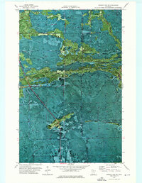
1973 Map of Norman Lake SW
USGS Topo · Published 1976About this map
The Pine Island State Forest dominates this northern Minnesota landscape, where the Tamarac River winds through a complex terrain of wetlands and dense timber. This orthophotomap, based on 1969 aerial photography, reveals the intricate drainage patterns of the region, including the course of Shotley Brook and the presence of a dedicated Rice Field. The map captures a significant boundary where the Red Lake Indian Reservation meets the state forest, illustrating the intersection of sovereign tribal lands and public forestry. A network of Winter Trails provides the primary evidence of seasonal access through this interior country, which straddles the line between Beltrami and Koochiching counties. The visual data highlights the transition from forest canopies to the open water of the river system, documenting the environment as it existed in the early 1970s.
Find a feature on this map
9 named features on this map. Tap any name to fly to it.
Don’t see what you’re looking for? This feature index may not catch every label — zoom into the map to look around manually.
Map Details
Editions of this 1973 Norman Lake SW Map
This is the sole edition of this map. No revisions or reprints were ever made.
Other maps of this area

1919 · Fox
USGS Topo · 1:62,500

1919 · Quiring
USGS Topo · 1:62,500

1919 · Norden
USGS Topo · 1:62,500

1919 · Bridgie
USGS Topo · 1:62,500

1924 · Bridgie
USGS Topo · 1:62,500

1954 · Bemidji
USGS Topo · 1:250,000

1954 · Roseau
USGS Topo · 1:250,000

1957 · Roseau
USGS Topo · 1:250,000

1957 · Bemidji
USGS Topo · 1:250,000

1958 · Bemidji
USGS Topo · 1:250,000