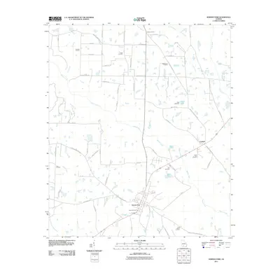
2011 Map of Norman Park
USGS Topo · Published 2011About this map
Norman Park and the smaller settlement of Crosland anchor this Colquitt County landscape, where agriculture is deeply intertwined with the hydrologic network of Warrior Creek and its many tributaries. The area is marked by numerous family-named landmarks and rural burial grounds, including the Paulks Cemetery, Galson Cemetery, and Tompkins Cemetery, providing essential data points for local genealogists. The presence of Baker Memorial Park near the center of Norman Park reflects the community's organized civic layout.
Find a feature on this map
67 named features on this map. Tap any name to fly to it.
Don’t see what you’re looking for? This feature index may not catch every label — zoom into the map to look around manually.
Map Details
Editions of this 2011 Norman Park Map
This is the sole edition of this map. No revisions or reprints were ever made.
Other maps of this area

1953 · Waycross
USGS Topo · 1:250,000

1956 · Doerun
USGS Topo · 1:62,500

1958 · Waycross
USGS Topo · 1:250,000

1973 · Ty Ty
USGS Topo · 1:24,000

1973 · Norman Park
USGS Topo · 1:24,000

1973 · Tifton West
USGS Topo · 1:24,000

1973 · Omega
USGS Topo · 1:24,000
1974 · Tempy
USGS Topo · 1:24,000
1974 · Sigsbee
USGS Topo · 1:24,000

1974 · Pineboro
USGS Topo · 1:24,000