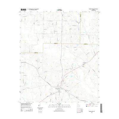
2014 Map of Norman Park
USGS Topo · Published 2014About this map
Norman Park sits at the heart of this agricultural landscape in Colquitt County, defined by a dense network of country roads and numerous family cemeteries. The terrain is drained by a complex system of waterways, including Warrior Cr, Rocky Cr, and Ty Ty Cr, which carve through the low-lying coastal plain. The settlement of Crosland appears in the northeast, positioned along the highway corridor.
Find a feature on this map
93 named features on this map. Tap any name to fly to it.
Don’t see what you’re looking for? This feature index may not catch every label — zoom into the map to look around manually.
Map Details
Editions of this 2014 Norman Park Map
This is the sole edition of this map. No revisions or reprints were ever made.
Other maps of this area

1953 · Waycross
USGS Topo · 1:250,000

1956 · Doerun
USGS Topo · 1:62,500

1958 · Waycross
USGS Topo · 1:250,000

1973 · Ty Ty
USGS Topo · 1:24,000

1973 · Norman Park
USGS Topo · 1:24,000

1973 · Tifton West
USGS Topo · 1:24,000

1973 · Omega
USGS Topo · 1:24,000
1974 · Tempy
USGS Topo · 1:24,000
1974 · Sigsbee
USGS Topo · 1:24,000

1974 · Pineboro
USGS Topo · 1:24,000