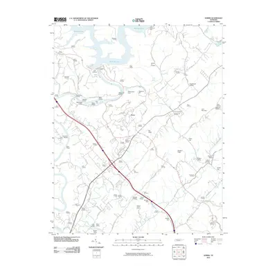
2010 Map of Norris
USGS Topo · Published 2010About this map
Norris Dam anchors the landscape where the Clinch River is harnessed to form the expansive waters of Big Ridge Lake. This planned landscape in Anderson County reflects mid-twentieth-century infrastructure and conservation efforts, as seen in the designated green spaces and recreational areas surrounding the town of Norris. The terrain is defined by a series of parallel ridges and valleys, including River Ridge, Bluebird Ridge, and Big Valley, which dictate the winding paths of roads like the Norris Fwy.
Find a feature on this map
116 named features on this map. Tap any name to fly to it.
Don’t see what you’re looking for? This feature index may not catch every label — zoom into the map to look around manually.
Map Details
Editions of this 2010 Norris Map
This is the sole edition of this map. No revisions or reprints were ever made.
Other maps of this area

1893 · Briceville
USGS Topo · 1:125,000

1895 · Briceville
USGS Topo · 1:125,000

1896 · Briceville
USGS Topo · 1:125,000

1897 · Maynardville
USGS Topo · 1:125,000

1900 · Maynardville
USGS Topo · 1:125,000

1935 · Fountain City
USGS Topo · 1:24,000

1936 · Gorryton
USGS Topo · 1:48,000

1936 · Jacksboro
USGS Topo · 1:24,000

1936 · White Hollow
USGS Topo · 1:24,000

1936 · La Follette
USGS Topo · 1:48,000