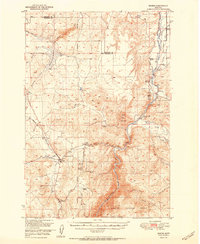
1951 Map of Norris
USGS Topo · Published 1951About this map
Mining legacies and ranching homesteads define this Madison County landscape at the midpoint of the twentieth century. The settlement of Norris serves as a local hub near the Northern Pacific rail line, while the surrounding hills are dotted with former extraction sites like the Waterlode Mine, Helene Mine, and Boaz Mine. These inactive mines and the nearby Red Bluff Cem provide a window into the earlier mineral booms that once drove the region's economy.
Find a feature on this map
34 named features on this map. Tap any name to fly to it.
Don’t see what you’re looking for? This feature index may not catch every label — zoom into the map to look around manually.
Map Details
Editions of this 1951 Norris Map
2 editions found

Other maps of this area

1888 · Three Forks
USGS Topo · 1:250,000

1894 · Three Forks
USGS Topo · 1:250,000

1895 · Three Forks
USGS Topo · 1:250,000

1947 · Bozeman
USGS Topo · 1:250,000

1948 · Bozeman
USGS Topo · 1:250,000

1949 · Anceney
USGS Topo · 1:62,500

1949 · Manhattan
USGS Topo · 1:62,500

1949 · Ennis
USGS Topo · 1:62,500

1949 · Norris
USGS Topo · 1:62,500

1950 · Three Forks
USGS Topo · 1:62,500