
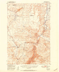
1951 Map of Norris
USGS Topo · Published 1951About this map
The Madison River carves a deep path through the center of this landscape, flanked by a complex network of irrigation infrastructure including the Jorgenson Ditch, Sloan Ditch, and Noble Ditch. The settlement of Norris serves as a local hub near Norris Hot Springs, while the surrounding terrain is marked by legacy mining operations such as the Boaz Mine and Grubstake Mine. This era shows a transition in the local economy, as these mines are noted as inactive, while established homesteads like Denike Ranch and Stephens Ranch represent the enduring ranching presence in the region.
Find a feature on this map
42 named features on this map. Tap any name to fly to it.
Don’t see what you’re looking for? This feature index may not catch every label — zoom into the map to look around manually.
Map Details
Editions of this 1951 Norris Map
2 editions found
Other maps of this area

1888 · Three Forks
USGS Topo · 1:250,000

1894 · Three Forks
USGS Topo · 1:250,000

1895 · Three Forks
USGS Topo · 1:250,000

1947 · Bozeman
USGS Topo · 1:250,000

1948 · Bozeman
USGS Topo · 1:250,000

1949 · Anceney
USGS Topo · 1:62,500

1949 · Manhattan
USGS Topo · 1:62,500

1949 · Ennis
USGS Topo · 1:62,500

1949 · Norris
USGS Topo · 1:62,500

1950 · Three Forks
USGS Topo · 1:62,500