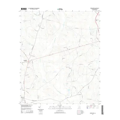
2014 Map of Norristown
USGS Topo · Published 2014About this map
The Little Ohoopee River and its numerous tributaries, including Covena Br and Open Cr, define the drainage patterns of this Emanuel County landscape. Modern infrastructure like the Emanuel County Airport and Us-80 intersect with older rural landmarks that reflect the area's social history. Small communities center around Norristown and Norristown Junction, while the surrounding countryside is dotted with family and community burial grounds such as Lambs Cem, Old Thompson Cem, and Union Cem. The presence of the Ebenezer Church and its adjacent Ebenezer Cem provides a focal point for local genealogical research. This survey illustrates the transition from traditional agricultural land use toward modern transportation and aviation needs, all while maintaining the footprints of early 21st-century rural settlements.
Find a feature on this map
82 named features on this map. Tap any name to fly to it.
Don’t see what you’re looking for? This feature index may not catch every label — zoom into the map to look around manually.
Map Details
Editions of this 2014 Norristown Map
This is the sole edition of this map. No revisions or reprints were ever made.
Other maps of this area

1957 · Macon
USGS Topo · 1:250,000

1958 · Macon
USGS Topo · 1:250,000

1964 · Macon
USGS Topo · 1:250,000

1970 · Covena
USGS Topo · 1:24,000

1970 · Nunez
USGS Topo · 1:24,000

1971 · Norristown
USGS Topo · 1:24,000

1971 · Swainsboro
USGS Topo · 1:24,000

1971 · Soperton North
USGS Topo · 1:24,000

1971 · Dellwood
USGS Topo · 1:24,000

1971 · Summertown
USGS Topo · 1:24,000