
1971 Map of Summertown
USGS Topo · Published 1974About this map
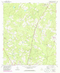
Summertown and its rural surroundings in Emanuel County are defined by the Central of Georgia Railroad, which bisects the landscape as it passes through the settlements of Blun and Modoc. The terrain is shaped by the winding tributaries of the Canoochee River, including the North Prong Canoochee Creek and South Prong Canoochee Creek. This early 1970s survey illustrates a community anchored by numerous country churches, such as New Hope Ch, Oak Grove Ch, and Hawhammock Ch, many of which are accompanied by small local cemeteries. The inclusion of Old Dellwood and a small Landing Strip north of Canoochee Creek reflects the region's agricultural character and the scattered nature of its traditional rural centers. Genealogists will find particular value in the distribution of family-named water features like Daniels Mill Creek and the specific placement of various unnamed burial grounds.
Find a feature on this map
21 named features on this map. Tap any name to fly to it.
Don’t see what you’re looking for? This feature index may not catch every label — zoom into the map to look around manually.
Map Details
Editions of this 1971 Summertown Map
2 editions found
Other maps of this area

1957 · Macon
USGS Topo · 1:250,000

1958 · Macon
USGS Topo · 1:250,000

1964 · Macon
USGS Topo · 1:250,000

1971 · Norristown
USGS Topo · 1:24,000

1971 · Swainsboro
USGS Topo · 1:24,000

1971 · Dellwood
USGS Topo · 1:24,000

1971 · Twin City
USGS Topo · 1:24,000
1971 · Canoochee
USGS Topo · 1:24,000

1973 · Colemans Lake
USGS Topo · 1:24,000
1973 · Wadley
USGS Topo · 1:24,000