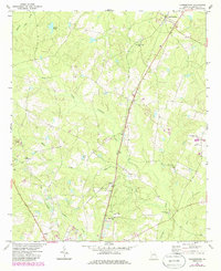
1971 Map of Summertown
USGS Topo · Published 1986About this map
Summertown and its rural environs in Emanuel County are defined by the branching waters of North Prong Canoochee Creek and South Prong Canoochee Creek. In the early 1970s, the Central of Georgia Railroad remained the primary north-south artery through this landscape, connecting the small communities of Blun and Modoc. The area is notable for its concentration of country churches, including New Hope Ch, Second Union Ch, and Hawhammock Ch, which often served as the focal points for local social and family life. Significant updates from 1981, marked in purple, show the addition of a Landing Strip and a Radio Tower, reflecting gradual changes in the rural infrastructure. Historical settlements like Old Dellwood and natural features such as Jenkins Pond and Flat Creek further characterize this quiet stretch of Georgia's coastal plain.
Find a feature on this map
20 named features on this map. Tap any name to fly to it.
Don’t see what you’re looking for? This feature index may not catch every label — zoom into the map to look around manually.
Map Details
Editions of this 1971 Summertown Map
2 editions found
Other maps of this area

1957 · Macon
USGS Topo · 1:250,000

1958 · Macon
USGS Topo · 1:250,000

1964 · Macon
USGS Topo · 1:250,000

1971 · Norristown
USGS Topo · 1:24,000

1971 · Swainsboro
USGS Topo · 1:24,000

1971 · Dellwood
USGS Topo · 1:24,000

1971 · Twin City
USGS Topo · 1:24,000
1971 · Canoochee
USGS Topo · 1:24,000

1971 · Summertown
USGS Topo · 1:24,000

1973 · Colemans Lake
USGS Topo · 1:24,000