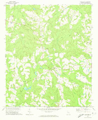
1971 Map of Canoochee
USGS Topo · Published 1974About this map
Canoochee serves as the focal point of this rural Emanuel County landscape in the early 1970s, where small church congregations and family burial grounds dot the coastal plain terrain. The map traces a network of spiritual and social hubs including Mt Gilead Ch, Mt Olivet Ch, and Roberts Grove Ch, many with adjacent cemeteries like Mt Gilead Cem and Noonday Cem. The drainage patterns of Canoochee Creek and Fifteenmile Creek dominate the hydrology, alongside Overstreet Lake.
Find a feature on this map
23 named features on this map. Tap any name to fly to it.
Don’t see what you’re looking for? This feature index may not catch every label — zoom into the map to look around manually.
Map Details
Editions of this 1971 Canoochee Map
This is the sole edition of this map. No revisions or reprints were ever made.
Other maps of this area

1957 · Macon
USGS Topo · 1:250,000

1958 · Macon
USGS Topo · 1:250,000

1964 · Macon
USGS Topo · 1:250,000

1971 · Swainsboro
USGS Topo · 1:24,000

1971 · Twin City
USGS Topo · 1:24,000
1971 · Twin City SE
USGS Topo · 1:24,000
1971 · Garfield
USGS Topo · 1:24,000

1971 · Summertown
USGS Topo · 1:24,000

1973 · Colemans Lake
USGS Topo · 1:24,000
1974 · Birdsville
USGS Topo · 1:24,000