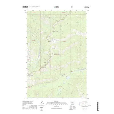
2020 Map of Norse Peak
USGS Topo · Published 2020About this map
Norse Peak stands as a central landmark along the rugged boundary between Pierce and Yakima counties, where the high-altitude terrain of the Snoqualmie National Forest meets the eastern edge of Mount Rainier National Park. This 2020 survey documents the intricate network of alpine paths, most notably the Pacific Crest National Scenic Trail as it winds north through Scout Pass and Hayden Pass. The map highlights a landscape defined by significant elevation changes, from the heights of Castle Mtn and Gold Hill to the deep basins of Bullion Basin and Pickhandle Basin. Water features like Goat Lake and Hen Skin Lake dot the ridges, feeding into the headwaters of the Greenwater River and the American River. In the southeast, the Chinook Pass Highway provides access to the Lodgepole Campground, marking a rare corridor of modern infrastructure in this preserved wilderness.
Find a feature on this map
60 named features on this map. Tap any name to fly to it.
Don’t see what you’re looking for? This feature index may not catch every label — zoom into the map to look around manually.
Map Details
Editions of this 2020 Norse Peak Map
This is the sole edition of this map. No revisions or reprints were ever made.
Other maps of this area

1901 · Snoqualmie Pass
USGS Topo · 1:125,000

1902 · Mount Aix
USGS Topo · 1:125,000

1903 · Snoqualmie
USGS Topo · 1:125,000

1904 · Mt Aix
USGS Topo · 1:125,000

1913 · Cedar Lake
USGS Topo · 1:125,000

1924 · Mt Rainier
USGS Topo · 1:96,000

1928 · Mt Rainier
USGS Topo · 1:125,000

1950 · Yakima
USGS Topo · 1:250,000

1956 · Greenwater
USGS Topo · 1:62,500

1957 · Wenatchee
USGS Topo · 1:250,000