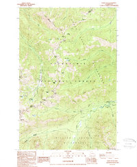
1988 Map of Norse Peak
USGS Topo · Published 1988About this map
The high Cascades at the Pierce and Yakima County line are documented in this late-1980s topographic record, defined by the intersection of three major wilderness areas. The Pacific Crest National Scenic Trail traverses the high ridges, passing landmarks such as Norse Peak and Scout Pass as it follows the crest between the Snoqualmie National Forest and the Norse Peak Wilderness. Historical extraction is evidenced by a Mine and Mines located near the upper reaches of Morse Creek, suggesting the area's prospecting past before its designation as protected land.
Find a feature on this map
45 named features on this map. Tap any name to fly to it.
Don’t see what you’re looking for? This feature index may not catch every label — zoom into the map to look around manually.
Map Details
Editions of this 1988 Norse Peak Map
2 editions found
Other maps of this area

1901 · Snoqualmie Pass
USGS Topo · 1:125,000

1902 · Mount Aix
USGS Topo · 1:125,000

1903 · Snoqualmie
USGS Topo · 1:125,000

1904 · Mt Aix
USGS Topo · 1:125,000

1913 · Cedar Lake
USGS Topo · 1:125,000

1924 · Mt Rainier
USGS Topo · 1:96,000

1928 · Mt Rainier
USGS Topo · 1:125,000

1950 · Yakima
USGS Topo · 1:250,000

1956 · Greenwater
USGS Topo · 1:62,500

1957 · Wenatchee
USGS Topo · 1:250,000