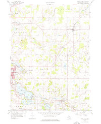
1959 Map of North Adams
USGS Topo · Published 1976About this map
The New York Central railroad corridor serves as the industrial spine of this Hillsdale County landscape, connecting the village of North Adams to the regional hub of Hillsdale. The city of Hillsdale is shown in detail, anchored by Mill Pond and the Lake View Cem, while the southern residential and recreation areas extend toward Baw Beese Lake and the Hillsdale Country Club.
Find a feature on this map
47 named features on this map. Tap any name to fly to it.
Don’t see what you’re looking for? This feature index may not catch every label — zoom into the map to look around manually.
Map Details
Editions of this 1959 North Adams Map
3 editions found
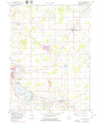
Other maps of this area

1935 · Jackson
USGS Topo · 1:48,000

1939 · Jackson
USGS Topo · 1:62,500

1948 · Spring Arbor
USGS Topo · 1:62,500

1949 · Spring Arbor
USGS Topo · 1:62,500

1953 · Fort Wayne
USGS Topo · 1:250,000

1956 · Fort Wayne
USGS Topo · 1:250,000

1958 · Grand Rapids
USGS Topo · 1:250,000

1959 · Hillsdale
USGS Topo · 1:24,000

1959 · Reading
USGS Topo · 1:24,000

1959 · North Adams
USGS Topo · 1:24,000