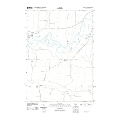
2010 Map of North Bend
USGS Topo · Published 2010About this map
The Black River winds through this rural landscape, carving a complex system of channels and oxbows as it passes the small settlement of North Bend. The terrain is defined by a dense network of coulees and valleys, where family names and local landmarks like Sandberg Valley, Severson Coulee, and Sullivan Coulee suggest a deep history of land use and homesteading. To the south, the village of Mindoro sits near the headwaters of Fleming Creek, while Burr Oak occupies a central position along the road network.
Find a feature on this map
55 named features on this map. Tap any name to fly to it.
Don’t see what you’re looking for? This feature index may not catch every label — zoom into the map to look around manually.
Map Details
Editions of this 2010 North Bend Map
This is the sole edition of this map. No revisions or reprints were ever made.
Other maps of this area

1909 · Sparta
USGS Topo · 1:62,500

1926 · North Bend
USGS Topo · 1:62,500

1927 · La Crosse
USGS Topo · 1:62,500

1928 · Melrose
USGS Topo · 1:48,000

1929 · North Bend
USGS Topo · 1:62,500

1930 · La Crosse
USGS Topo · 1:62,500

1947 · Sparta
USGS Topo · 1:62,500

1949 · Sparta
USGS Topo · 1:62,500

1949 · Melrose
USGS Topo · 1:62,500

1953 · Eau Claire
USGS Topo · 1:250,000