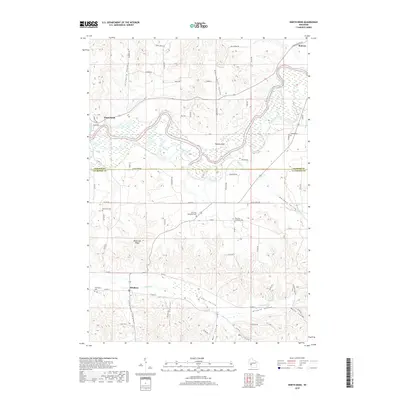
2018 Map of North Bend
USGS Topo · Published 2018About this map
Black River meanders across this landscape where Jackson and La Crosse counties meet, defining a region of steep coulees and named valleys. The terrain transitions from the river bottom near Maiden Rock to the high ground of Black Oak Ridge, revealing a landscape carved by Severson Coulee, Sullivan Coulee, and Heller Coulee. This 2018 survey captures the persistent rural character of settlements like North Bend, Melrose, and Mindoro. For genealogists, the map is particularly rich in cemetery data, pinpointing sites such as Burr Oak Methodist Cem, Burr Oak Lutheran Cem, and the remote Farmington Cem. The network of backroads, including Sandberg Rd and Red School Rd, follows the natural contours of the Sandberg and Red School valleys, illustrating how the geography has dictated movement and settlement patterns for generations.
Find a feature on this map
74 named features on this map. Tap any name to fly to it.
Don’t see what you’re looking for? This feature index may not catch every label — zoom into the map to look around manually.
Map Details
Editions of this 2018 North Bend Map
This is the sole edition of this map. No revisions or reprints were ever made.
Other maps of this area

1909 · Sparta
USGS Topo · 1:62,500

1926 · North Bend
USGS Topo · 1:62,500

1927 · La Crosse
USGS Topo · 1:62,500

1928 · Melrose
USGS Topo · 1:48,000

1929 · North Bend
USGS Topo · 1:62,500

1930 · La Crosse
USGS Topo · 1:62,500

1947 · Sparta
USGS Topo · 1:62,500

1949 · Sparta
USGS Topo · 1:62,500

1949 · Melrose
USGS Topo · 1:62,500

1953 · Eau Claire
USGS Topo · 1:250,000