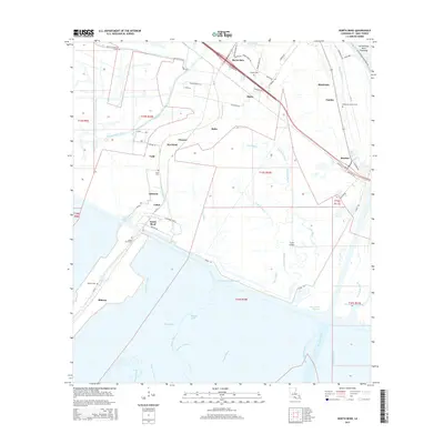
2015 Map of North Bend
USGS Topo · Published 2015About this map
Bayou Sale and the Intracoastal Waterway define the hydraulic character of this St. Mary Parish landscape, where a dense network of coulees and bayous meet engineered canals and channels. The settlement pattern follows the higher ground along the waterways, with linear communities like Shadyside, Fairfax, and Ricohoc positioned near the BNSF Railway corridor. Numerous family and community burial sites, including Douglas Cem and Shadyside-Fairfax Cem, are preserved across the lowlands, reflecting a deep-seated genealogy tied to the coastal prairies. The map details the transition from agricultural land to the marshy outlets of the Wax Lake Outlet and Wax North Channel, illustrating the complex water management systems of the Atchafalaya Basin Floodway. South of North Bend, the landscape opens into a maze of named channels like Bayou Blue and Plume Bayou, showing the natural deltaic progression toward the coast.
Find a feature on this map
79 named features on this map. Tap any name to fly to it.
Don’t see what you’re looking for? This feature index may not catch every label — zoom into the map to look around manually.
Map Details
Editions of this 2015 North Bend Map
This is the sole edition of this map. No revisions or reprints were ever made.
Other maps of this area

1935 · Belle Isle
USGS Topo · 1:31,680

1937 · Bayou Sale
USGS Topo · 1:62,500

1937 · Jeanerette
USGS Topo · 1:62,500

1941 · Belle Isle
USGS Topo · 1:62,500

1945 · New Orleans
USGS Topo · 1:250,000

1948 · Foster
USGS Topo · 1:62,500

1954 · Jeanerette
USGS Topo · 1:62,500

1954 · Belle Isle
USGS Topo · 1:62,500

1957 · Bayou Sale
USGS Topo · 1:62,500

1959 · Foster
USGS Topo · 1:62,500