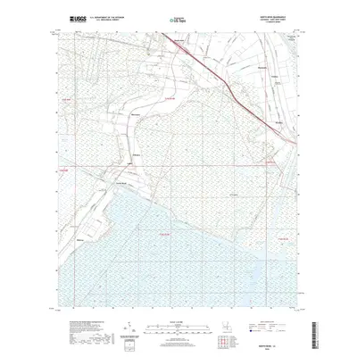
2020 Map of North Bend
USGS Topo · Published 2020About this map
North Bend and its surrounding coastal marshland define this portion of St. Mary Parish, where the land fragmentizes into a complex network of bayous and man-made canals. This recent survey captures the modern hydraulic landscape of the Atchafalaya Basin Floodway, showing how the Intracoastal Waterway and the massive Wax Lake Outlet dominate the regional drainage. The map provides significant genealogical value through its documentation of several family and community burial sites, including the North Bend Cem, Shadyside - Fairfax Cem, and the Douglas Cem near the settlement of Bayou Sale. While industrial footprints like the Columbia Chemical facilities are evident, the geography remains deeply tied to the water, with traditional place names like Ricohoc and Maryland persisting alongside modern infrastructure such as the Garden City Levee Foot Trail.
Find a feature on this map
85 named features on this map. Tap any name to fly to it.
Don’t see what you’re looking for? This feature index may not catch every label — zoom into the map to look around manually.
Map Details
Editions of this 2020 North Bend Map
This is the sole edition of this map. No revisions or reprints were ever made.
Other maps of this area

1935 · Belle Isle
USGS Topo · 1:31,680

1937 · Bayou Sale
USGS Topo · 1:62,500

1937 · Jeanerette
USGS Topo · 1:62,500

1941 · Belle Isle
USGS Topo · 1:62,500

1945 · New Orleans
USGS Topo · 1:250,000

1948 · Foster
USGS Topo · 1:62,500

1954 · Jeanerette
USGS Topo · 1:62,500

1954 · Belle Isle
USGS Topo · 1:62,500

1957 · Bayou Sale
USGS Topo · 1:62,500

1959 · Foster
USGS Topo · 1:62,500