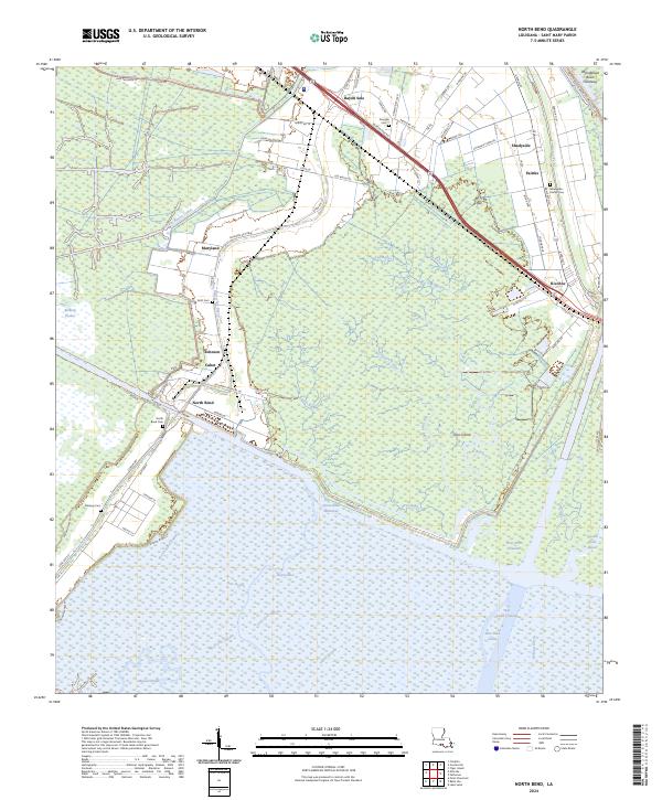
2024 Map of North Bend
USGS Topo · Published 2024About this map
The Bayou Teche National Wildlife Refuge anchors this low-lying landscape where the intricate waterways of St. Mary Parish meet the Atchafalaya basin. The map reveals a transition from managed wetlands to agricultural and residential pockets like Maryland, Bayou Sale, and North Bend. Settlement patterns here are dictated by the elevation of natural levees, with roads and dwellings clustered along the winding course of the Teche and the Atchafalaya Basin Spillway Levee. Deep into the marshy southern reaches, the Intracoastal Waterway cuts through the terrain, connecting Bear Bayou and Crow Bayou to larger industrial channels. For family historians, several small burial grounds are documented, including Shadyside-Fairfax Cem and North Bend Cem, which serve as quiet markers of the communities that have long inhabited these coastal prairies and bayou banks.
Find a feature on this map
83 named features on this map. Tap any name to fly to it.
Don’t see what you’re looking for? This feature index may not catch every label — zoom into the map to look around manually.
Map Details
Editions of this 2024 North Bend Map
This is the sole edition of this map. No revisions or reprints were ever made.
Other maps of this area

1935 · Belle Isle
USGS Topo · 1:31,680

1937 · Bayou Sale
USGS Topo · 1:62,500

1937 · Jeanerette
USGS Topo · 1:62,500

1941 · Belle Isle
USGS Topo · 1:62,500

1945 · New Orleans
USGS Topo · 1:250,000

1948 · Foster
USGS Topo · 1:62,500

1954 · Jeanerette
USGS Topo · 1:62,500

1954 · Belle Isle
USGS Topo · 1:62,500

1957 · Bayou Sale
USGS Topo · 1:62,500

1959 · Foster
USGS Topo · 1:62,500