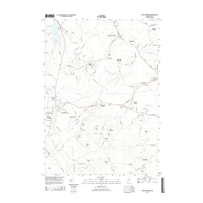
2014 Map of North Berwick
USGS Topo · Published 2014About this map
North Berwick and its surrounding rural hamlets are meticulously charted here, revealing a landscape defined by small clusters like Saywards Corner, Perkins Town, and Grays Corner. The topography transitions from the high points of Bald Hill and the Tatnic Hills down to the winding waters of the Merriland River and Ogunquit River. This survey captures the region's dense network of local roads and historical land divisions, including specific family-named plots such as the Baston Lot, Winn Lot, and Boston Lot. For genealogists, the map is a vital resource for locating small, isolated burial grounds, including the Bald Hill Graveyard, Elm Brook Cem, and the Quaker Cem near the Great Works River. The presence of several crossings, such as Varney Crossing and Hobbs Crossing, highlights the enduring importance of historical transit points across the York County terrain.
Find a feature on this map
147 named features on this map. Tap any name to fly to it.
Don’t see what you’re looking for? This feature index may not catch every label — zoom into the map to look around manually.
Map Details
Editions of this 2014 North Berwick Map
This is the sole edition of this map. No revisions or reprints were ever made.
Other maps of this area

1891 · Berwick
USGS Topo · 1:62,500

1891 · Kennebunk
USGS Topo · 1:62,500

1893 · Kennebunk
USGS Topo · 1:62,500

1893 · Dover
USGS Topo · 1:62,500

1893 · Berwick
USGS Topo · 1:62,500

1893 · York
USGS Topo · 1:62,500

1898 · Kennebunk
USGS Topo · 1:62,500

1916 · Dover
USGS Topo · 1:62,500

1918 · Dover
USGS Topo · 1:62,500

1920 · York
USGS Topo · 1:62,500