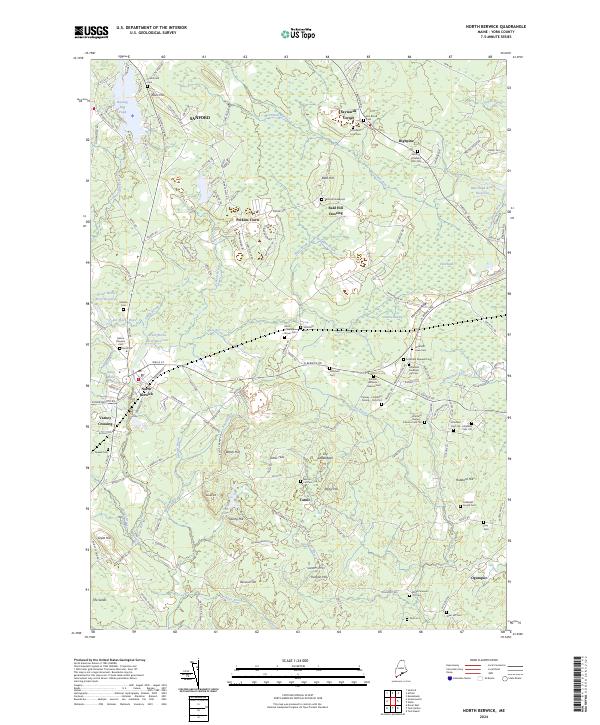
2024 Map of North Berwick
USGS Topo · Published 2024About this map
North Berwick and the neighboring hills of southern Maine appear here in contemporary detail, reflecting a landscape defined by its network of brooks and scattered family burying grounds. The geography is shaped by the Great Works River Reservoir and the Merriland River, with residential clusters at Saywards Corner, Perkins Town, and Highpine. Genealogists will find this sheet particularly valuable for its density of small family cemeteries, including the Littlefield Family Cem, Hatch-Littlefield-Stover Cem, and the Bald Hill Graveyard.
Find a feature on this map
159 named features on this map. Tap any name to fly to it.
Don’t see what you’re looking for? This feature index may not catch every label — zoom into the map to look around manually.
Map Details
Editions of this 2024 North Berwick Map
This is the sole edition of this map. No revisions or reprints were ever made.
Other maps of this area

1891 · Berwick
USGS Topo · 1:62,500

1891 · Kennebunk
USGS Topo · 1:62,500

1893 · Kennebunk
USGS Topo · 1:62,500

1893 · Dover
USGS Topo · 1:62,500

1893 · Berwick
USGS Topo · 1:62,500

1893 · York
USGS Topo · 1:62,500

1898 · Kennebunk
USGS Topo · 1:62,500

1916 · Dover
USGS Topo · 1:62,500

1918 · Dover
USGS Topo · 1:62,500

1920 · York
USGS Topo · 1:62,500