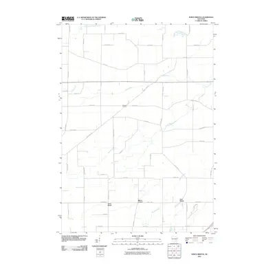
2010 Map of North Bristol
USGS Topo · Published 2010About this map
North Bristol and the surrounding agricultural landscapes of northern Dane County are defined by a network of rural routes and river systems in this 2010 survey. The topography is shaped by the southern flow of the Maunesha River and the meandering paths of the Crawfish River and its North Branch. These waterways bisect a grid of established local roads, including County Hwy-V and County Hwy-K, which connect small clusters of development like East Bristol and Bakers Corners. For genealogists and local historians, the inclusion of Hampden Cemetery and numerous family-named roads such as Reisgard Rd, Loeffler Rd, and Davidson Rd provides concrete data points for tracing 21st-century land use and lineage in this part of Windsor.
Find a feature on this map
43 named features on this map. Tap any name to fly to it.
Don’t see what you’re looking for? This feature index may not catch every label — zoom into the map to look around manually.
Map Details
Editions of this 2010 North Bristol Map
This is the sole edition of this map. No revisions or reprints were ever made.
Other maps of this area

1890 · Madison
USGS Topo · 1:62,500

1890 · Sun Prairie
USGS Topo · 1:62,500

1892 · Madison
USGS Topo · 1:62,500

1896 · Sun Prairie
USGS Topo · 1:62,500

1901 · Poynette
USGS Topo · 1:62,500

1904 · Madison
USGS Topo · 1:62,500

1905 · Sun Prairie
USGS Topo · 1:62,500

1906 · Madison
USGS Topo · 1:62,500

1907 · Sun Prairie
USGS Topo · 1:62,500

1955 · Columbus
USGS Topo · 1:62,500