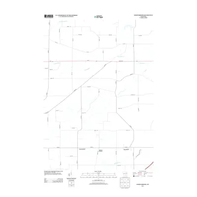
2013 Map of North Bristol
USGS Topo · Published 2013About this map
North Bristol and East Bristol anchor the southern portion of this agricultural quadrangle, illustrating the enduring layout of rural crossroads communities in Dane County. The landscape is defined by the winding courses of the Crawfish River and the Maunesha River, which cut through a grid of established township roads. Family-named thoroughfares such as Berkvam Rd, Reisgard Rd, and Hasey Rd trace the historical property lines and homesteads of the region, providing valuable reference points for genealogists tracking local land ownership. Significant transportation corridors like State Road 60 and Co Hwy-V connect these quiet hamlets to the broader Wisconsin dairy country, while the northern reaches remain sparsely developed, dominated by the N Br Crawfish River and large open tracts.
Find a feature on this map
47 named features on this map. Tap any name to fly to it.
Don’t see what you’re looking for? This feature index may not catch every label — zoom into the map to look around manually.
Map Details
Editions of this 2013 North Bristol Map
This is the sole edition of this map. No revisions or reprints were ever made.
Other maps of this area

1890 · Madison
USGS Topo · 1:62,500

1890 · Sun Prairie
USGS Topo · 1:62,500

1892 · Madison
USGS Topo · 1:62,500

1896 · Sun Prairie
USGS Topo · 1:62,500

1901 · Poynette
USGS Topo · 1:62,500

1904 · Madison
USGS Topo · 1:62,500

1905 · Sun Prairie
USGS Topo · 1:62,500

1906 · Madison
USGS Topo · 1:62,500

1907 · Sun Prairie
USGS Topo · 1:62,500

1955 · Columbus
USGS Topo · 1:62,500