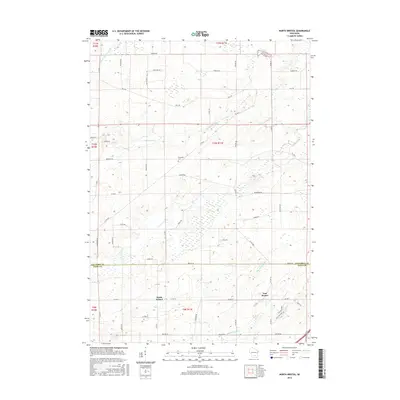
2016 Map of North Bristol
USGS Topo · Published 2016About this map
North Bristol and East Bristol anchor the southern portion of this landscape, situated along the border of Columbia and Dane Counties. The terrain is defined by the headwaters and meandering courses of the Crawfish River and its North Branch, alongside the Maunesha River to the south. This area is characterized by a dense network of country roads named for local families, such as Monson Rd, Reisgard Rd, and Hall Rd, which trace the agricultural divisions of the land. A notable site for local history is the Hampden Cem located centrally in Hampden Township. The map illustrates a modern rural landscape where traditional farmsteads meet newer residential developments, evident in the naming of streets like Suffolk Down and Esker Trl in the southeastern corner.
Find a feature on this map
29 named features on this map. Tap any name to fly to it.
Don’t see what you’re looking for? This feature index may not catch every label — zoom into the map to look around manually.
Map Details
Editions of this 2016 North Bristol Map
This is the sole edition of this map. No revisions or reprints were ever made.
Other maps of this area

1890 · Madison
USGS Topo · 1:62,500

1890 · Sun Prairie
USGS Topo · 1:62,500

1892 · Madison
USGS Topo · 1:62,500

1896 · Sun Prairie
USGS Topo · 1:62,500

1901 · Poynette
USGS Topo · 1:62,500

1904 · Madison
USGS Topo · 1:62,500

1905 · Sun Prairie
USGS Topo · 1:62,500

1906 · Madison
USGS Topo · 1:62,500

1907 · Sun Prairie
USGS Topo · 1:62,500

1955 · Columbus
USGS Topo · 1:62,500