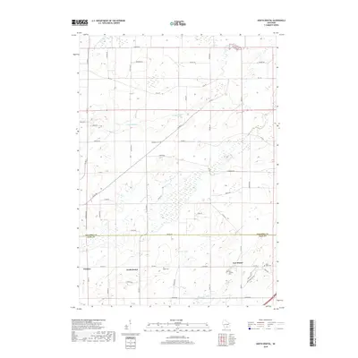
2018 Map of North Bristol
USGS Topo · Published 2018About this map
North Bristol and East Bristol anchor this agricultural landscape along the boundary shared by Columbia and Dane Counties. The terrain is defined by the winding course of the Maunesha River in the south and the upper reaches of the Crawfish River, including the North Branch Crawfish River. This rural geography is heavily influenced by a grid of farm-to-market roads such as Bristol Road and Monson Road, reflecting a pattern of long-standing family landholdings and small-scale crossroad settlements. Several burial grounds, including Hampden Cemetery and Baker Cemetery, offer significant points of interest for those tracing local lineages. The presence of Saint Joseph's Cemetery and Saint Peter Cemetery near East Bristol highlights the importance of parish communities in shaping the region's cultural and social structure during its development.
Find a feature on this map
34 named features on this map. Tap any name to fly to it.
Don’t see what you’re looking for? This feature index may not catch every label — zoom into the map to look around manually.
Map Details
Editions of this 2018 North Bristol Map
This is the sole edition of this map. No revisions or reprints were ever made.
Other maps of this area

1890 · Madison
USGS Topo · 1:62,500

1890 · Sun Prairie
USGS Topo · 1:62,500

1892 · Madison
USGS Topo · 1:62,500

1896 · Sun Prairie
USGS Topo · 1:62,500

1901 · Poynette
USGS Topo · 1:62,500

1904 · Madison
USGS Topo · 1:62,500

1905 · Sun Prairie
USGS Topo · 1:62,500

1906 · Madison
USGS Topo · 1:62,500

1907 · Sun Prairie
USGS Topo · 1:62,500

1955 · Columbus
USGS Topo · 1:62,500