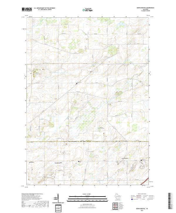
2022 Map of North Bristol
USGS Topo · Published 2022About this map
The boundary between Columbia and Dane Counties divides this agricultural landscape, where the headwaters of several regional waterways begin their course. The Crawfish River and its tributary, the N Br Crawfish River, meander through the northern half of the region, while the Maunesha River flows through the southern sections near the settlement of East Bristol. This area is characterized by a dense network of country roads named for local families and early settlers, including Reisgard Rd, Conlon Rd, and Duborg Rd, which connect small crossroads communities. Genealogists will find several well-preserved burial sites across the landscape, such as Hampden Cem in the center and Saint Joseph's Cem to the east. The map captures the quiet, rural character of south-central Wisconsin, where the villages of North Bristol and Windsor serve as local hubs for the surrounding farmsteads.
Find a feature on this map
57 named features on this map. Tap any name to fly to it.
Don’t see what you’re looking for? This feature index may not catch every label — zoom into the map to look around manually.
Map Details
Editions of this 2022 North Bristol Map
This is the sole edition of this map. No revisions or reprints were ever made.
Other maps of this area

1890 · Madison
USGS Topo · 1:62,500

1890 · Sun Prairie
USGS Topo · 1:62,500

1892 · Madison
USGS Topo · 1:62,500

1896 · Sun Prairie
USGS Topo · 1:62,500

1901 · Poynette
USGS Topo · 1:62,500

1904 · Madison
USGS Topo · 1:62,500

1905 · Sun Prairie
USGS Topo · 1:62,500

1906 · Madison
USGS Topo · 1:62,500

1907 · Sun Prairie
USGS Topo · 1:62,500

1955 · Columbus
USGS Topo · 1:62,500