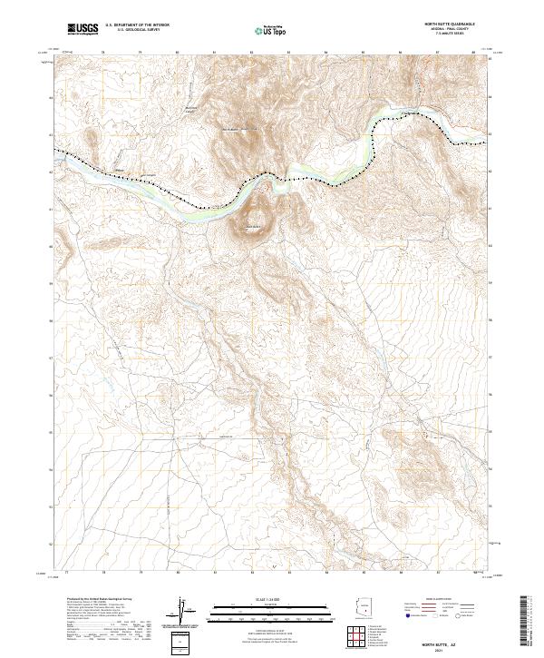
2021 Map of North Butte
USGS Topo · Published 2021About this map
The Gila River cuts through the desert terrain of Pinal County, carving a path between prominent geological landmarks such as North Butte, South Butte, and the Double Peaks. This 2021 survey reveals a landscape defined by significant drainage networks, including Donnelly Wash, Chylla Wash, and Box O Wash, which feed toward the river valley. Sparse settlements are concentrated at Cochran and Price, situated near the water's edge. The area is traversed by the Arizona National Scenic Trl, offering a modern perspective on the ancient routes through Box Canyon and Martinez Canyon. Local access is provided by a network of ranch and mineral roads, such as Red Mt Mine Rd and Whitlow Ranch Rd, which hint at the region's ongoing intersection of recreation and traditional land use.
Find a feature on this map
25 named features on this map. Tap any name to fly to it.
Don’t see what you’re looking for? This feature index may not catch every label — zoom into the map to look around manually.
Map Details
Editions of this 2021 North Butte Map
This is the sole edition of this map. No revisions or reprints were ever made.
Other maps of this area

1900 · Florence
USGS Topo · 1:125,000

1902 · Florence
USGS Topo · 1:125,000

1922 · Red Rock No 2
USGS Topo · 1:48,000

1934 · Newman Peak
USGS Topo · 1:125,000

1954 · Mesa
USGS Topo · 1:250,000

1956 · Tucson
USGS Topo · 1:250,000

1957 · Mesa
USGS Topo · 1:250,000

1958 · Mesa
USGS Topo · 1:250,000

1958 · Tucson
USGS Topo · 1:250,000

1959 · Tucson
USGS Topo · 1:250,000