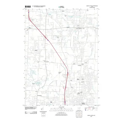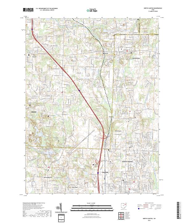
2023 Map of North Canton
USGS Topo · Published 2023About this map
The Tuscarawas River flows through a landscape of suburban expansion and historical burial grounds at the boundary of Summit and Stark counties. In this modern survey, the dense street grid of North Canton and the northern reaches of Canton contrast with the open spaces of the Akron-Canton Regional Airport and Mayfield Airport. Local history is preserved in numerous cemeteries and burying grounds that dot the quadrangle, from the Jonathan Grable Burying Ground near Greensburg Cem to the Saint Paul Cem in McDonaldsville. Residential developments and corporate corridors like Corporate Woods Pkwy increasingly define the terrain between established settlements like Uniontown, Green, and Greentown. Small water bodies, including Tritts Millpond, Willowdale Lake, and Lake Slagle, remain as quiet landmarks amidst the busy infrastructure of the Stark and Summit county line.
Find a feature on this map
300 named features on this map. Tap any name to fly to it.
Don’t see what you’re looking for? This feature index may not catch every label — zoom into the map to look around manually.
Map Details
Editions of this 2023 North Canton Map
This is the sole edition of this map. No revisions or reprints were ever made.
Historical Maps of Green Through Time
8 maps found