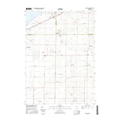
2016 Map of North Cape
USGS Topo · Published 2016About this map
The agricultural and residential landscape of Southeast Wisconsin is anchored here by several small settlements where the borders of Milwaukee, Waukesha, and Racine counties meet. The unincorporated community of North Cape sits along Raynor Ave, a primary north-south corridor that separates the western marshlands from the more developed eastern townships. This area is characterized by a high density of local cemeteries, including the Luther Parker Cem near Durham and the Oak Grove Cem near Kneeland, which provide valuable location data for genealogists tracking early settlers of the region. The map also reveals a surprising concentration of private aviation facilities, such as Aero Estates Airport and the Cindy Guntly Memorial Airport, reflecting the region's modern aviation history alongside established landmarks like the Union Church. Drainage and water management are evident through features like the Cross Canal and Goose Lake Br Canal, which intersect the low-lying terrain south of Muskego Lake.
Find a feature on this map
77 named features on this map. Tap any name to fly to it.
Don’t see what you’re looking for? This feature index may not catch every label — zoom into the map to look around manually.
Map Details
Editions of this 2016 North Cape Map
This is the sole edition of this map. No revisions or reprints were ever made.
Other maps of this area

1891 · Bayview
USGS Topo · 1:62,500

1891 · Muskego
USGS Topo · 1:62,500

1892 · Racine
USGS Topo · 1:62,500

1893 · Silver Lake
USGS Topo · 1:62,500

1901 · Bayview
USGS Topo · 1:62,500

1901 · Muskego
USGS Topo · 1:62,500

1905 · Racine
USGS Topo · 1:62,500

1906 · Silver Lake
USGS Topo · 1:62,500

1954 · Rockford
USGS Topo · 1:250,000

1955 · Rockford
USGS Topo · 1:250,000