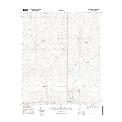
2015 Map of North Carrollton
USGS Topo · Published 2015About this map
North Carrollton and Carrollton anchor the southern portion of this Mississippi landscape, situated along the winding course of Big Sand Creek. The area is defined by a dense network of tributaries including Teoc Cr, Billups Cr, and Beasley Cr, which carve through the terrain of Carroll County. This 2015 survey reveals a deeply established rural community characterized by numerous family and memorial burial grounds. Genealogists may find particular interest in the distribution of sites such as Moores Memorial Cem, Old Union Cem, and Evergreen Cem. The map illustrates the transition from the concentrated street grids of the twin municipalities to the sprawling timber and agricultural lands of the surrounding townships, connected by a web of county roads like Bethel Rd and Mill Dr that follow the natural contours of the northern hills.
Find a feature on this map
114 named features on this map. Tap any name to fly to it.
Don’t see what you’re looking for? This feature index may not catch every label — zoom into the map to look around manually.
Map Details
Editions of this 2015 North Carrollton Map
This is the sole edition of this map. No revisions or reprints were ever made.
Other maps of this area

1936 · Greenwood
USGS Topo · 1:62,500

1940 · Seven Pines
USGS Topo · 1:62,500

1940 · Greenwood
USGS Topo · 1:62,500

1953 · Greenwood
USGS Topo · 1:250,000

1953 · West Point
USGS Topo · 1:250,000

1954 · McCarley
USGS Topo · 1:62,500

1956 · Greenwood
USGS Topo · 1:250,000

1957 · Greenwood
USGS Topo · 1:62,500

1957 · Seven Pines
USGS Topo · 1:62,500

1958 · West Point
USGS Topo · 1:250,000