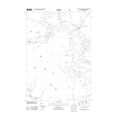
2012 Map of North Conway West
USGS Topo · Published 2012About this map
North Conway and the Saco River valley anchor this topographical portrait of a landscape defined by both recreation and heritage. The landmark North Conway Depot stands at the edge of town, signaling the area's history as a rail-accessible destination, while the nearby Post Office at Intervale serves as a local hub. Significant geological landmarks like Cathedral Ledge and White Horse Ledge rise sharply above the valley floor, overlooking the waters of Echo Lake.
Find a feature on this map
101 named features on this map. Tap any name to fly to it.
Don’t see what you’re looking for? This feature index may not catch every label — zoom into the map to look around manually.
Map Details
Editions of this 2012 North Conway West Map
This is the sole edition of this map. No revisions or reprints were ever made.
Other maps of this area

1894 · North Conway
USGS Topo · 1:62,500

1895 · Crawford Notch
USGS Topo · 1:62,500

1896 · Crawford Notch
USGS Topo · 1:62,500

1896 · North Conway
USGS Topo · 1:62,500

1930 · Ossipee Lake
USGS Topo · 1:62,500

1931 · Mt. Chocorua
USGS Topo · 1:62,500

1942 · North Conway
USGS Topo · 1:62,500

1945 · North Conway
USGS Topo · 1:62,500

1946 · Crawford Notch
USGS Topo · 1:62,500

1949 · Portland
USGS Topo · 1:250,000