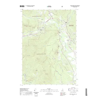
2021 Map of North Conway West
USGS Topo · Published 2021About this map
White Mountain National Forest dominates this mountain landscape, where the Saco River and Ellis River converge near Glen. The valley floor is defined by the Mount Washington Valley, a corridor of settlement and transport that includes Lower Bartlett, Intervale, and the railroad-inflected history of Cooks Crossing. This area is characterized by dramatic granite features and water-carved landmarks, most notably the towering Cathedral Ledge, White Horse Ledge, and the cascades at Dianas Baths. Historical crossing points like Bartlett Bridge and Albany Bridge anchor the local road network, while the western terrain rises sharply into the White Mountains range. These peaks, including North Moat Mtn and Big Attitash Mtn, reflect a rugged topography that has long shaped the development of timber and tourism in Carroll County.
Find a feature on this map
105 named features on this map. Tap any name to fly to it.
Don’t see what you’re looking for? This feature index may not catch every label — zoom into the map to look around manually.
Map Details
Editions of this 2021 North Conway West Map
This is the sole edition of this map. No revisions or reprints were ever made.
Other maps of this area

1894 · North Conway
USGS Topo · 1:62,500

1895 · Crawford Notch
USGS Topo · 1:62,500

1896 · Crawford Notch
USGS Topo · 1:62,500

1896 · North Conway
USGS Topo · 1:62,500

1930 · Ossipee Lake
USGS Topo · 1:62,500

1931 · Mt. Chocorua
USGS Topo · 1:62,500

1942 · North Conway
USGS Topo · 1:62,500

1945 · North Conway
USGS Topo · 1:62,500

1946 · Crawford Notch
USGS Topo · 1:62,500

1949 · Portland
USGS Topo · 1:250,000