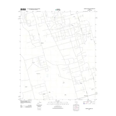
2012 Map of North Cowden
USGS Topo · Published 2012About this map
The North Cowden Oil Field and North Cowden Deep Oil Field define this Permian Basin landscape, where a dense network of local roads and extraction sites overlies traditional ranching lands. Grounded in Ector County, the map reveals a modern industrial-agricultural hybrid, marked by the presence of Flynt Ranch and Conger Ranch. Distinctive named landmarks like the Rich Uncle Windmill, Alley Oople Windmill, and White Windmill serve as essential water points across the arid terrain. The settlement of North Cowden anchors the southern portion of the quadrangle, while the Comanche Trails Camp offers a rare recreational or educational site amidst the heavy machinery of the East Goldsmith Oil Field. The grid of roads, including Clabber Hill Rd and Ranch Road 1936, facilitates the intensive energy production characterizing the region in the early 21st century.
Find a feature on this map
27 named features on this map. Tap any name to fly to it.
Don’t see what you’re looking for? This feature index may not catch every label — zoom into the map to look around manually.
Map Details
Editions of this 2012 North Cowden Map
This is the sole edition of this map. No revisions or reprints were ever made.
Other maps of this area

1954 · Hobbs
USGS Topo · 1:250,000

1954 · Pecos
USGS Topo · 1:250,000

1957 · Pecos
USGS Topo · 1:250,000

1958 · Hobbs
USGS Topo · 1:250,000

1964 · Odessa NW
USGS Topo · 1:24,000

1964 · Turnbaugh Corner
USGS Topo · 1:24,000

1965 · Goldsmith
USGS Topo · 1:24,000

1967 · North Cowden
USGS Topo · 1:24,000

1968 · Coyote Corner
USGS Topo · 1:24,000

1968 · North Cowden NW
USGS Topo · 1:24,000