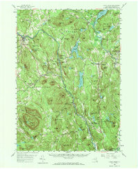
1958 Map of North Creek
USGS Topo · Published 1970About this map
The Hudson River winds through the heart of this Warren County landscape, joined by the Schroon River as it passes through the southern Adirondacks. In the late 1950s, the Delaware and Hudson railroad follows the river's western bank, serving the community of North Creek and passing through Riparius (Riverside Sta). The map details a transition from river-bottom settlements like Wevertown and The Glen to the high elevations of Crane Mountain, which features a lookout tower at its summit.
Find a feature on this map
151 named features on this map. Tap any name to fly to it.
Don’t see what you’re looking for? This feature index may not catch every label — zoom into the map to look around manually.
Map Details
Editions of this 1958 North Creek Map
Other maps of this area

1895 · North Creek
USGS Topo · 1:62,500

1895 · Paradox Lake
USGS Topo · 1:62,500

1895 · Glens Falls
USGS Topo · 1:62,500

1897 · Bolton
USGS Topo · 1:62,500

1897 · Glens Falls
USGS Topo · 1:62,500

1897 · Paradox Lake
USGS Topo · 1:62,500

1897 · North Creek
USGS Topo · 1:62,500

1897 · Schroon Lake
USGS Topo · 1:62,500

1898 · Newcomb
USGS Topo · 1:62,500

1898 · Thirteenth Lake
USGS Topo · 1:62,500