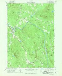
1968 Map of North Creek
USGS Topo · Published 1970About this map
The Hudson River carves a deep valley through the rugged topography of Adirondack State Park, serving as the primary corridor for both the Delaware and Hudson railroad and the region's early settlements. In the late 1960s, the village of North Creek serves as a local hub, featuring the Central School and the Bennett Landing Strip. The surrounding landscape is defined by significant elevations like Oven Mountain and Henderson Mtn, with smaller hamlets such as Wevertown and Sodom situated along the winding mountain roads. The map reveals a high density of named water bodies, including Antler Lake, Waldron Pond, and Hidden Lake, which illustrate the drainage patterns of the Johnsburg and Chester townships. This 1968 field-checked record captures the area before modern development, preserving the location of family cemeteries and remote mountain passes like Byrnes Corners.
Find a feature on this map
57 named features on this map. Tap any name to fly to it.
Don’t see what you’re looking for? This feature index may not catch every label — zoom into the map to look around manually.
Map Details
Editions of this 1968 North Creek Map
2 editions found
Other maps of this area

1895 · North Creek
USGS Topo · 1:62,500

1897 · North Creek
USGS Topo · 1:62,500

1897 · Schroon Lake
USGS Topo · 1:62,500

1898 · Newcomb
USGS Topo · 1:62,500

1898 · Thirteenth Lake
USGS Topo · 1:62,500

1901 · Newcomb
USGS Topo · 1:62,500

1950 · Glens Falls
USGS Topo · 1:250,000

1950 · Utica
USGS Topo · 1:250,000

1953 · Schroon Lake
USGS Topo · 1:62,500

1954 · Newcomb
USGS Topo · 1:62,500