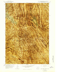
1966 Map of North Emblem Reservoir
USGS Topo · Published 1969About this map
North Emblem Reservoir and a series of smaller impoundments like Cleopatra Reservoir and Caesar Reservoir define the water management of this Big Horn County landscape during the mid-1960s. This orthophotomap reveals a highly industrial character, marked by extensive Bentonite Mines and numerous Oil Wells scattered across the township lines. The terrain is deeply carved by drainage systems including Dry Creek, East Fork Sand Draw, and Lovell Draw, illustrating the relationship between natural geography and the extraction of mineral resources. A prominent Pipeline and U.S. Route 310 provide the primary infrastructure for this active energy and mining district, while the presence of several isolated drill holes suggests an era of continued subsurface exploration.
Find a feature on this map
19 named features on this map. Tap any name to fly to it.
Don’t see what you’re looking for? This feature index may not catch every label — zoom into the map to look around manually.
Map Details
Editions of this 1966 North Emblem Reservoir Map
3 editions found
Other maps of this area

1955 · Cody
USGS Topo · 1:250,000

1958 · Cody
USGS Topo · 1:250,000

1962 · Cody
USGS Topo · 1:250,000

1964 · Kane
USGS Topo · 1:24,000

1964 · Lovell Lakes
USGS Topo · 1:24,000
1966 · Sheep Canyon
USGS Topo · 1:24,000

1966 · North Emblem Reservoir
USGS Topo · 1:24,000

1966 · Jack Horner Reservoir
USGS Topo · 1:24,000

1966 · Emblem SE
USGS Topo · 1:24,000
1966 · Lovell
USGS Topo · 1:24,000