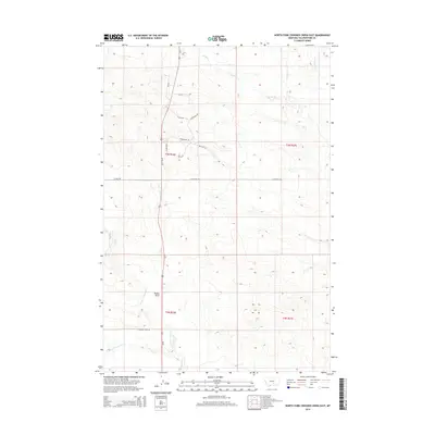
2014 Map of North Fork Crooked Creek East
USGS Topo · Published 2014About this map
Us-87 serves as the primary north-south axis through this section of Yellowstone County, cutting across a landscape defined by the drainage basins of Razor Cr and Crooked Cr. The terrain is characterized by the distinct Hoskin Basin, where the headwaters of the N Fork Crooked Cr begin their descent. Small-scale residential development and ranch access are evident through a network of named local roads such as Stonehouse Rd, Lindstrom Rd, and Cottontail Trl. The transition between the W Razor Cr and the main branch of Razor Cr highlights the intricate hydrologic patterns of this Montana high country. This modern survey reflects the contemporary parceling of rural land, where traditional ranching geography meets newer named residential lanes like Megan Ln and Jana Ln.
Find a feature on this map
22 named features on this map. Tap any name to fly to it.
Don’t see what you’re looking for? This feature index may not catch every label — zoom into the map to look around manually.
Map Details
Editions of this 2014 North Fork Crooked Creek East Map
This is the sole edition of this map. No revisions or reprints were ever made.
Other maps of this area

1893 · Huntley
USGS Topo · 1:125,000

1954 · Billings
USGS Topo · 1:250,000

1954 · Roundup
USGS Topo · 1:250,000

1956 · Rattlesnake Butte
USGS Topo · 1:24,000

1956 · Hickson Ranch
USGS Topo · 1:24,000

1956 · Huntley
USGS Topo · 1:24,000

1957 · Billings
USGS Topo · 1:250,000

1958 · Billings
USGS Topo · 1:250,000

1958 · Roundup
USGS Topo · 1:250,000

1979 · Roundup
USGS Topo · 1:100,000