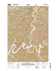
2014 Map of North Fork
USGS Topo · Published 2014About this map
The North Fork Smith River carves a winding path through this portion of the Siuslaw National Forest along the border of Lane and Douglas Counties. This landscape is defined by its dramatic relief, where ridges such as Sulphur Ridge and Robinson Ridge separate deep drainage basins. The small settlement of North Fork is situated at the confluence of the river branches, serving as a focal point for the surrounding timberlands and canyons.
Find a feature on this map
52 named features on this map. Tap any name to fly to it.
Don’t see what you’re looking for? This feature index may not catch every label — zoom into the map to look around manually.
Map Details
Editions of this 2014 North Fork Map
This is the sole edition of this map. No revisions or reprints were ever made.
Other maps of this area

1919 · Earl
USGS Topo · 1:48,000

1920 · Siltcoos Lake
USGS Topo · 1:62,500

1923 · Reedsport
USGS Topo · 1:62,500

1941 · Siltcoos Lake
USGS Topo · 1:62,500

1942 · Siltcoos Lake
USGS Topo · 1:62,500

1942 · Reedsport
USGS Topo · 1:62,500

1943 · Goodwin Peak
USGS Topo · 1:62,500

1954 · Coos Bay
USGS Topo · 1:250,000

1955 · Scottsburg
USGS Topo · 1:62,500
1956 · Reedsport
USGS Topo · 1:62,500